Love the idea of stepping from your front door to a mountain trail, a quiet greenway, or a scenic parkway overlook? In Black Mountain, that outdoor lifestyle is part of everyday life. Whether you’re relocating, searching for a second home, or simply planning your next weekend, you want clear insight on where to go, what to expect in each season, and how outdoor access affects real estate choices. This guide gives you a local’s view of recreation options, safety and permits, and the practical homebuying details that matter. Let’s dive in.
Black Mountain at a glance
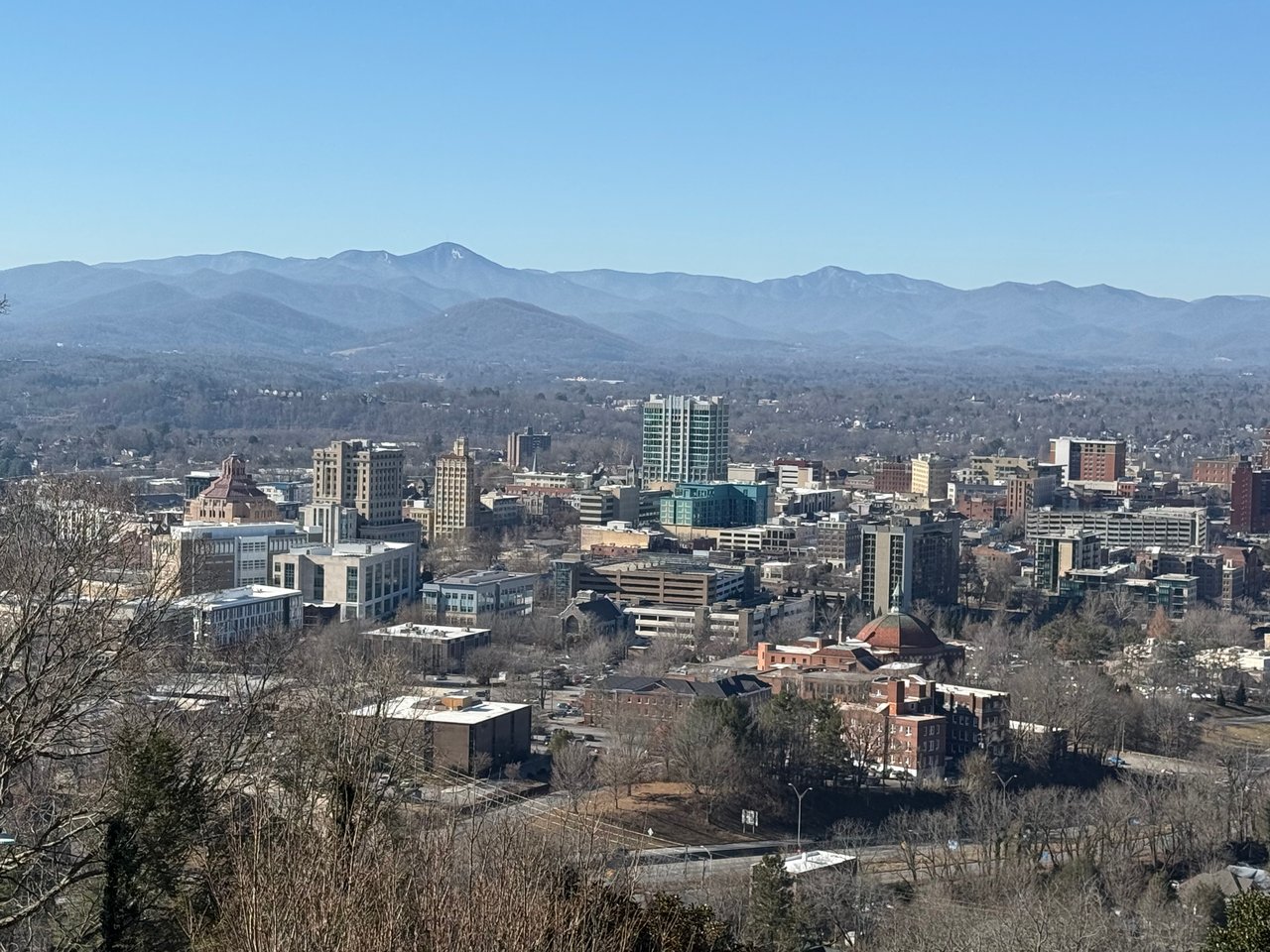
Black Mountain sits in the Swannanoa River valley east of Asheville, surrounded by the Blue Ridge Mountains. You’re minutes from ridgelines, state and federal public lands, and the Blue Ridge Parkway corridor. The terrain is steep and forested, with small creeks feeding larger watersheds and big elevation changes as you climb out of the valley.
You’ll experience four true seasons. Spring brings wildflowers and sometimes muddy trails. Summer is warm and humid in the valley but cooler higher up. Fall is a major draw for leaf color that varies with elevation. Winter sees occasional snow and ice in town with heavier accumulation at higher elevations, which can affect road and driveway access.
Seasons and what to expect
Spring
Expect variable temperatures and soft, wet trails early in the season. Wildflowers are excellent, especially at lower elevations. Pack layers and plan for mud.
Summer
Valley days run warm and humid, while ridges feel cooler and breezier. This is peak recreation season, so start early to avoid crowds and heat.
Fall
Leaf season is a marquee event. Timing varies by elevation, so you can often chase color over several weeks. Parking near popular overlooks and trailheads fills quickly.
Winter
Higher elevations get more frequent snow and ice, which may close certain roads and impact steep driveways. Winter hiking and snowshoeing are possible on appropriate trails when conditions allow.
Seasonal planning checklist
- Check weather and land-management advisories before you go.
- In spring, expect mud and use waterproof footwear.
- In summer, carry extra water and sun protection.
- In fall, plan for crowds and limited parking at peak times.
- In winter, prepare for ice, road closures, and traction needs.
Top ways to get outside
Hiking and easy walks
You have options for every comfort level. For a relaxed stroll, town-maintained parks and greenways offer lakeside loops and riverfront paths near Lake Tomahawk. For short scenic hikes, the Blue Ridge Parkway provides overlooks and well-marked options.
If you want more challenge, Pisgah National Forest has extensive loop and backcountry trails, plus access to old logging roads. Mount Mitchell State Park offers high-elevation trails and interpretive paths around the highest peaks in the region. Ridge trails can be windy or foggy, so bring layers and a map or GPS. Always use official National Park Service and U.S. Forest Service maps when planning routes.
Mountain biking, road, and gravel
Pisgah National Forest is a regional favorite for mountain biking on singletrack and forest roads. Technical features and steep climbs are common, so match routes to your skill level and consult local biking groups or official trail maps before you go.
Road cyclists enjoy scenic climbs on secondary roads and short stretches of the Blue Ridge Parkway. Gravel riders can link quiet backroads and forest routes for big views and rolling terrain. Visibility and weather can change fast, so ride prepared.
Water time: paddling, fishing, swimming
The Swannanoa River runs through the valley with sections that can be suitable for wading or paddling depending on flow. Many creeks and small lakes around the region are good for casual paddling. Mountain waterways rise quickly after rain and can be cold year-round, so assess conditions before you launch.
If you fish, streams and tailwater fisheries are managed by the North Carolina Wildlife Resources Commission and U.S. Forest Service. You’ll need the appropriate license and to follow current regulations and catch limits.
Rock climbing and bouldering
There is regional access to cliffs and outcrops across western North Carolina, though the immediate Black Mountain area is more limited than larger climbing hubs like Linville Gorge or Chimney Rock. Many climbers travel regionally for sport and trad routes. Always confirm that a crag is open and permitted, and follow Leave No Trace.
Winter hiking and snowshoeing
Black Mountain is not a downhill ski destination, but high ridges nearby see periodic snow. When conditions allow, you can hike or snowshoe on appropriate trails. For homeowners, winterization and driveway access planning are smart steps.
Trail running and equestrian options
Varied terrain and steady elevation gain make the region great for trail running. Some multi-use trails permit horses. Always check trail rules for bike, horse, and foot travel before you go.
Parks and trailheads to know
- Blue Ridge Parkway: A classic mountain drive with overlooks and short hikes managed by the National Park Service.
- Pisgah National Forest: Vast networks for hiking, biking, fishing, and backcountry travel managed by the U.S. Forest Service.
- Mount Mitchell State Park: High-elevation summit access and interpretive trails within the North Carolina State Parks system.
- Town parks and greenways: Municipal lakeside and riverfront paths near Lake Tomahawk and other town-maintained spaces.
- Local conservation lands: Preserved tracts maintained by regional conservation groups that add trail and open-space access.
Before you go, check the managing agency for closures, restrictions, and permits.
Rules, permits, and safety
- For the Blue Ridge Parkway, review rules for dogs, camping in designated campgrounds, and any permits for commercial or group use.
- In Pisgah National Forest, confirm camping and campfire regulations, group sizes, and any trail-specific rules for bikes or horses.
- For fishing and hunting, follow North Carolina Wildlife Resources Commission licensing and seasons.
- Within town and county parks, follow posted rules and leash laws.
Safety best practices include carrying a map or GPS, water, layers, and a small first-aid kit. Tell someone your route for longer outings. Mountain weather changes quickly, so check forecasts and advisories. Avoid ridge travel in lightning, secure trash and pet food to reduce bear encounters, and practice tick prevention. Follow Leave No Trace to protect trails, waterways, and cultural sites.
How outdoor access affects your home search
Being close to the mountains shapes day-to-day life and property decisions. Here’s what to consider as you shop for a home or land in and around Black Mountain.
Property and land-use basics
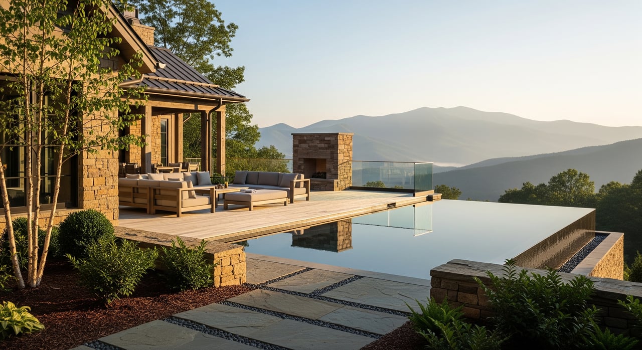
- Proximity to trails and parks: This can boost a property’s appeal and value. Homes directly next to popular trailheads may see parking overflow and seasonal noise.
- Easements and restrictions: Some parcels carry conservation easements or deed restrictions. Review county records and your title report.
- Zoning and building: Buncombe County and the Town of Black Mountain have zoning and permitting rules. Steep-slope standards, setbacks, and watershed protections may apply.
- Septic vs. sewer: Many mountain homes use septic. Verify the septic permit history and system capacity with the county health department.
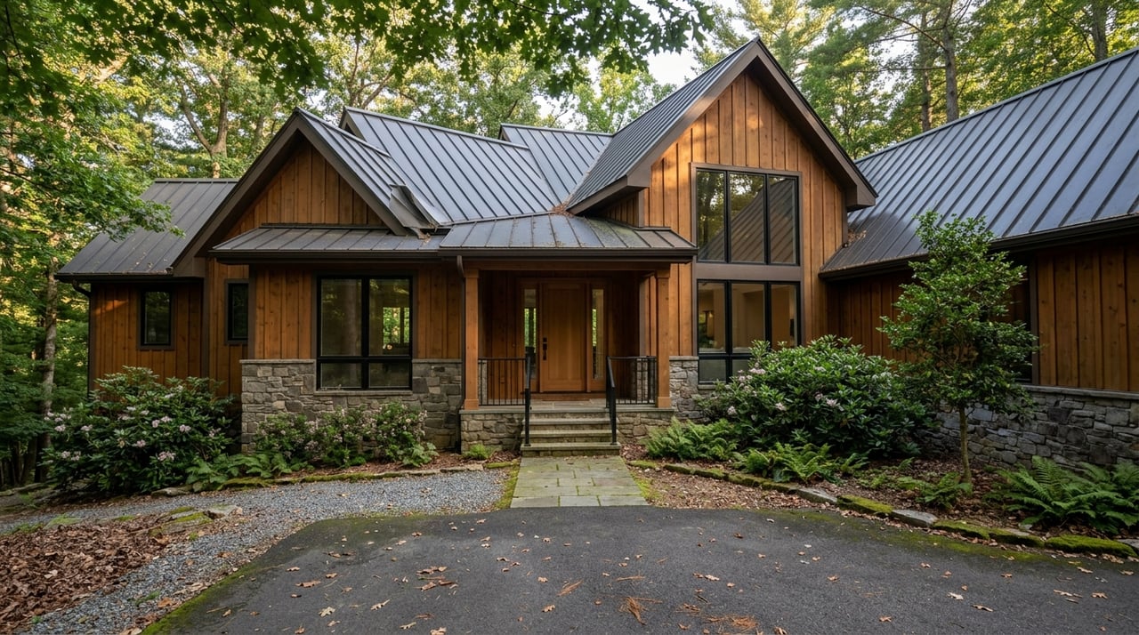
- Driveway and road access: Steep or narrow private drives are common. Consider winter access and whether emergency vehicles can reach the home.
Natural hazards to evaluate
- Flood risk: Parcels along the Swannanoa River and creeks may fall within FEMA flood zones. Review FEMA and county GIS floodplain maps.
- Landslides and slope stability: Steep terrain carries risk. Look for signs of slope movement and consider geotechnical input for steep lots.
- Wildfire exposure: Forested settings require defensible space and attention to seasonal fire restrictions.
- Wildlife and pests: Expect black bears, deer, and smaller mammals. Plan for rodent and tick prevention.
Insurance, utilities, and upkeep
- Insurance: Availability and rates vary by location and structure age. Coverage for wildfire or landslide may be limited. Get quotes early in due diligence.
- Utilities: Municipal water and sewer vary by area. Rural homes may rely on well and septic, which impacts design and maintenance.
- Maintenance: Higher precipitation and leaf litter mean more frequent roof, gutter, and drainage upkeep.
Neighborhood access and daily life
Many Black Mountain neighborhoods are a short drive to trailheads, Parkway overlooks, and forest access. Walkability varies by neighborhood, with downtown and lakeside areas typically offering the easiest non-driving access to parks and paths. If you are eyeing a home near a popular access point, visit at different times of day to gauge traffic and parking.
Local outfitters, guides, and outdoor retailers help with gear, instruction, and trip planning. You can also connect with hiking meetups, running clubs, and bike groups to find partners and learn local routes. Third-party trail portals and club pages are useful for recent conditions, but always verify final details with official maps and agency notices before you go.
New-to-town outdoor game plan
- Start with town greenways and lakeside loops to get your bearings.
- Add a short Blue Ridge Parkway overlook walk for views without a big climb.
- Graduate to moderate day hikes in Pisgah National Forest, checking trail difficulty and weather before you go.
- Explore high-elevation trails at Mount Mitchell State Park on clear days.
- For biking or paddling, connect with local groups and review official maps and rules.
Ready to make Black Mountain home?
If mountain trails, river time, and scenic drives are part of your week, Black Mountain is a natural fit. You deserve an advisor who understands outdoor access, steep-slope rules, septic due diligence, and how these details affect value and daily life. If you are weighing neighborhoods, second homes, or land with views, reach out. Unknown Company is here to help you find the right place and the right plan.
FAQs
What are easy outdoor options for new visitors in Black Mountain?
- Start with town greenways and lakeside loops near Lake Tomahawk, then add short scenic stops along the Blue Ridge Parkway.
Where can I find moderate to strenuous hikes near Black Mountain?
- Pisgah National Forest and Mount Mitchell State Park offer longer day hikes and steeper terrain for experienced hikers; check official maps first.
Do I need permits for camping or fishing around Black Mountain?
- Day hiking usually requires no permit, while some overnight or backcountry camping is regulated; fishing requires a state license and adherence to regulations.
How does living near a trailhead affect homeownership?
- Proximity adds appeal but can bring seasonal parking and noise; visit at peak times to assess impacts before you buy.
Are flood or landslide risks a concern in Black Mountain?
- Riverfront and low-lying parcels may be in FEMA flood zones, and steep lots can present slope stability concerns; review maps and consult professionals.
What should I know about winter in higher elevations near Black Mountain?
- Snow and ice are more common at higher elevations, which can affect road access and driveways; carry traction gear and plan for closures when storms move in.